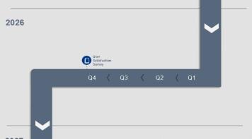
Bluenest by Globalvia, EUREKA and EGNOS combined: The Palma de Mallorca EUREKA Demo Day
In February 2026,…
![]() The EGNOS Helpdesk answers your questions 24/7. Call +34 911 236 555, email helpdesk@egnos.gsc-europa.eu, or use our online form.
The EGNOS Helpdesk answers your questions 24/7. Call +34 911 236 555, email helpdesk@egnos.gsc-europa.eu, or use our online form.
EGNOS was designed for aviation, and aviation continues to be a key segment for European GNSS. EGNOS increases accuracy and integrity, improving accessibility, efficiency and safety to operators, pilots and airports across Europe.
EGNOS allows lateral and angular vertical guidance during the Final Approach Segment (FAS) without requiring visual contact with the ground until a Decision Height (DH) down to only 200 feet above the runway (LPV minima as low as 200 feet).
EGNOS LPV-200 service:
Today, more than 460 EGNOS enabled approaches are operational in Europe and this figure will boost the implementation of the so-called Performance-Based Navigation (PNB). Consequently, European regional, business and general aviation operators are increasingly equipping their aircrafts with EGNOS-enabled avionics, allowing them to take advantage of already published procedures.


Bluenest by Globalvia, EUREKA and EGNOS combined: The Palma de Mallorca EUREKA Demo Day
In February 2026,…

The declaration of the EGNOS Safety of Life service in March 2011 marked the moment when satellite navigation became certified…

The User Consultation Platform (UCP) together with the Space Downstream Day registration is now open. The two-day event taking place 4-5…
This figure aims at providing a high-level overview of the EGNOS System and Services expected evolutions linked to the consecutive EGNOS…
This report presents the EGNOS services performance during December 2024. The report contains global results for the reported period,…
This report presents the EGNOS services performance during November 2024. The report contains global results for the reported period,…